
Thank you for supporting this site ❤️
Make a donation
Make a donation
Abetifi topographic map
Click on the map to display elevation.
Thank you for supporting this site ❤️
Make a donation
Make a donation
About this map
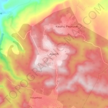
Name: Abetifi topographic map, elevation, terrain.
Location: Abetifi, Kwahu East District, Eastern Region, Ghana (6.63243 -0.78385 6.71243 -0.70385)
Average elevation: 480 m
Minimum elevation: 140 m
Maximum elevation: 643 m
Thank you for supporting this site ❤️
Make a donation
Make a donation