
Thank you for supporting this site ❤️
Make a donation
Make a donation
Fahlenscheid topographic map
Click on the map to display elevation.
Thank you for supporting this site ❤️
Make a donation
Make a donation
About this map
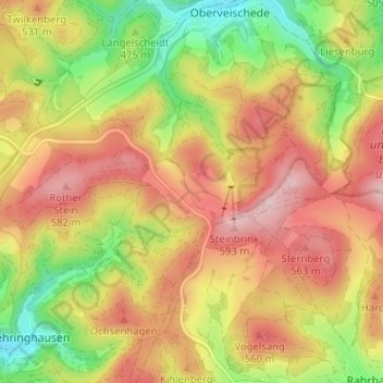
Name: Fahlenscheid topographic map, elevation, terrain.
Location: Fahlenscheid, Olpe, Kreis Olpe, Nordrhein-Westfalen, Deutschland (51.03763 7.92589 51.07763 7.96589)
Average elevation: 497 m
Minimum elevation: 382 m
Maximum elevation: 595 m
Thank you for supporting this site ❤️
Make a donation
Make a donation
Other topographic maps
Click on a map to view its topography, its elevation and its terrain.