
Chenillé-Changé topographic map
Interactive map
Click on the map to display elevation.
About this map
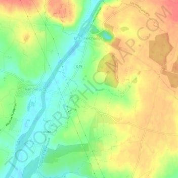
Name: Chenillé-Changé topographic map, elevation, terrain.
Average elevation: 48 m
Minimum elevation: 17 m
Maximum elevation: 79 m
Other topographic maps
Click on a map to view its topography, its elevation and its terrain.
Champteussé-sur-Baconne
France > Pays de la Loire > Maine-et-Loire > Chenillé-Champteussé
Champteussé-sur-Baconne, Chenillé-Champteussé, Segré, Maine-et-Loire, Pays de la Loire, France métropolitaine, 49220, France
Average elevation: 49 m