
Thank you for supporting this site ❤️
Make a donation
Make a donation
Daubenhorn topographic map
Click on the map to display elevation.
Thank you for supporting this site ❤️
Make a donation
Make a donation
About this map
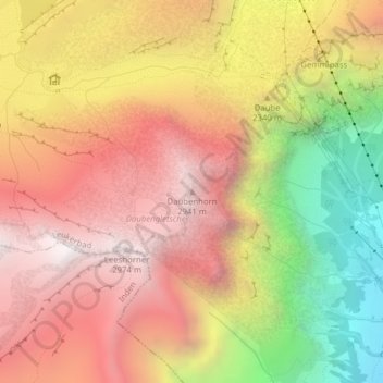
Name: Daubenhorn topographic map, elevation, terrain.
Location: Daubenhorn, Leukerbad, Leuk, Vallés, 3954, Suiza (46.38824 7.60279 46.38834 7.60289)
Average elevation: 2,311 m
Minimum elevation: 1,357 m
Maximum elevation: 2,988 m
Thank you for supporting this site ❤️
Make a donation
Make a donation