
부산진구 topographic map
Interactive map
Click on the map to display elevation.
About this map
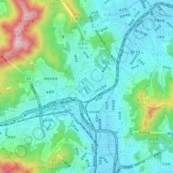
Name: 부산진구 topographic map, elevation, terrain.
Location: 부산진구, Busan, Corée du Sud (35.13467 129.00990 35.19939 129.08301)
Average elevation: 128 m
Minimum elevation: 1 m
Maximum elevation: 610 m
Other topographic maps
Click on a map to view its topography, its elevation and its terrain.