
Thank you for supporting this site ❤️
Make a donation
Make a donation
Forty Four topographic map
Click on the map to display elevation.
Thank you for supporting this site ❤️
Make a donation
Make a donation
About this map
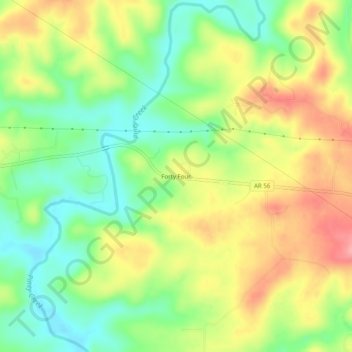
Name: Forty Four topographic map, elevation, terrain.
Location: Forty Four, Izard County, Arkansas, 72585, United States (36.12368 -92.08099 36.16368 -92.04099)
Average elevation: 177 m
Minimum elevation: 127 m
Maximum elevation: 236 m
Thank you for supporting this site ❤️
Make a donation
Make a donation
Other topographic maps
Click on a map to view its topography, its elevation and its terrain.