
Thank you for supporting this site ❤️
Make a donation
Make a donation
Rock Hill topographic map
Click on the map to display elevation.
Thank you for supporting this site ❤️
Make a donation
Make a donation
About this map
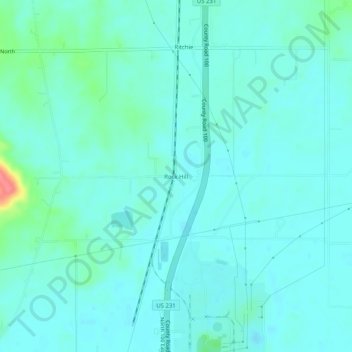
Name: Rock Hill topographic map, elevation, terrain.
Location: Rock Hill, Spencer County, Indiana, United States (37.92505 -87.06000 37.96505 -87.02000)
Average elevation: 124 m
Minimum elevation: 113 m
Maximum elevation: 183 m
Thank you for supporting this site ❤️
Make a donation
Make a donation
Other topographic maps
Click on a map to view its topography, its elevation and its terrain.