
See topographic map
Interactive map
Click on the map to display elevation.
About this map
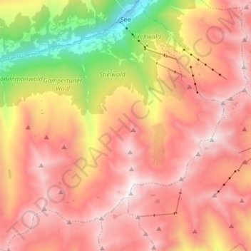
Name: See topographic map, elevation, terrain.
Location: See, Bezirk Landeck, Oostenrijk (47.00025 10.38791 47.09001 10.51834)
Average elevation: 2,201 m
Minimum elevation: 1,026 m
Maximum elevation: 2,997 m
Other topographic maps
Click on a map to view its topography, its elevation and its terrain.