
Fünen topographic map
Interactive map
Click on the map to display elevation.
About this map
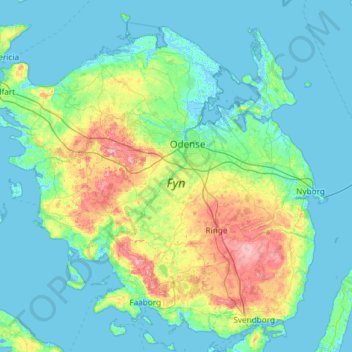
Name: Fünen topographic map, elevation, terrain.
Location: Fünen, Odense, Odense Kommune, Region Süddänemark, Dänemark (55.02661 9.67710 55.62268 10.85612)
Average elevation: 19 m
Minimum elevation: -6 m
Maximum elevation: 121 m