
Thank you for supporting this site ❤️
Make a donation
Make a donation
Rennerod topographic map
Click on the map to display elevation.
Thank you for supporting this site ❤️
Make a donation
Make a donation
About this map
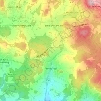
Name: Rennerod topographic map, elevation, terrain.
Location: Rennerod, Westerwaldkreis, Rijnland-Palts, 56477, Duitsland (50.58880 8.04175 50.64409 8.11498)
Average elevation: 507 m
Minimum elevation: 406 m
Maximum elevation: 632 m
Thank you for supporting this site ❤️
Make a donation
Make a donation