
Thank you for supporting this site ❤️
Make a donation
Make a donation
Tengger topographic map
Click on the map to display elevation.
Thank you for supporting this site ❤️
Make a donation
Make a donation
About this map
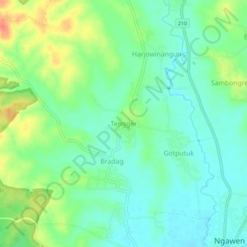
Name: Tengger topographic map, elevation, terrain.
Location: Tengger, Blora, Central Java, Java, Indonesia (-7.00477 111.27712 -6.96477 111.31712)
Average elevation: 91 m
Minimum elevation: 72 m
Maximum elevation: 126 m
Thank you for supporting this site ❤️
Make a donation
Make a donation