
Thank you for supporting this site ❤️
Make a donation
Make a donation
Saint-Samuel topographic map
Click on the map to display elevation.
Thank you for supporting this site ❤️
Make a donation
Make a donation
About this map
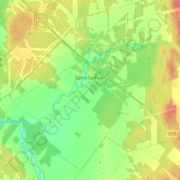
Name: Saint-Samuel topographic map, elevation, terrain.
Location: Saint-Samuel, Arthabaska, Centre-du-Québec, Québec, Canada (46.02253 -72.29050 46.10231 -72.16163)
Average elevation: 91 m
Minimum elevation: 69 m
Maximum elevation: 120 m
Thank you for supporting this site ❤️
Make a donation
Make a donation
Other topographic maps
Click on a map to view its topography, its elevation and its terrain.