
Make a donation
Ibaan topographic map
Click on the map to display elevation.
Make a donation
Ibaan
Ibaan is located at 13°49′03″N 121°07′59″E / 13.8176°N 121.133°E / 13.8176; 121.133. It is 13 kilometres (8.1 mi) from Batangas City and 118 kilometres (73 mi) from Manila. It is bounded on the northwest by San Jose, the northeast by Lipa City, the east by Rosario, the southeast by Taysan, and the southwest by Batangas City. It has a land area of 68.99 square kilometers (26.64 sq mi) at an altitude of 124 meters (407 ft) above sea level.
Make a donation
About this map
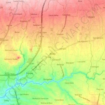
Name: Ibaan topographic map, elevation, terrain.
Location: Ibaan, Batangas, Calabarzon, 4230, Philippines (13.76784 121.09512 13.87127 121.18587)
Average elevation: 126 m
Minimum elevation: 10 m
Maximum elevation: 223 m
Make a donation
Other topographic maps
Click on a map to view its topography, its elevation and its terrain.