
Thank you for supporting this site ❤️
Make a donation
Make a donation
Hallangen topographic map
Click on the map to display elevation.
Thank you for supporting this site ❤️
Make a donation
Make a donation
About this map
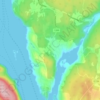
Name: Hallangen topographic map, elevation, terrain.
Location: Hallangen, Frogn, Comté d'Akershus, 1443, Norvège (59.68338 10.59816 59.72338 10.63816)
Average elevation: 58 m
Minimum elevation: -1 m
Maximum elevation: 223 m
Thank you for supporting this site ❤️
Make a donation
Make a donation
Other topographic maps
Click on a map to view its topography, its elevation and its terrain.