
Thank you for supporting this site ❤️
Make a donation
Make a donation
Roreto topographic map
Click on the map to display elevation.
Thank you for supporting this site ❤️
Make a donation
Make a donation
About this map
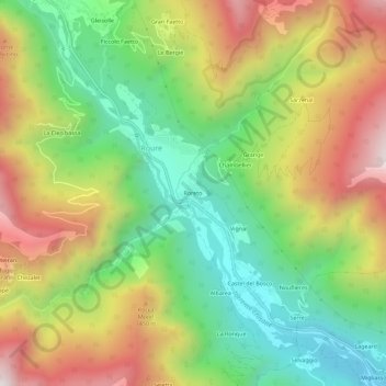
Name: Roreto topographic map, elevation, terrain.
Location: Roreto, Roure, Torino, Piemonte, Italia (44.97673 7.11550 45.01673 7.15550)
Average elevation: 1,186 m
Minimum elevation: 707 m
Maximum elevation: 1,809 m
Thank you for supporting this site ❤️
Make a donation
Make a donation
Other topographic maps
Click on a map to view its topography, its elevation and its terrain.