
Thank you for supporting this site ❤️
Make a donation
Make a donation
Lupfig topographic map
Click on the map to display elevation.
Thank you for supporting this site ❤️
Make a donation
Make a donation
About this map
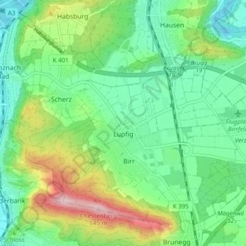
Name: Lupfig topographic map, elevation, terrain.
Location: Lupfig, Bezirk Brugg, Aargau, 5242, Switzerland (47.42632 8.17139 47.45715 8.24027)
Average elevation: 426 m
Minimum elevation: 337 m
Maximum elevation: 627 m
Thank you for supporting this site ❤️
Make a donation
Make a donation