
Make a donation
Alps Mesa topographic map
Click on the map to display elevation.
Make a donation
About this map
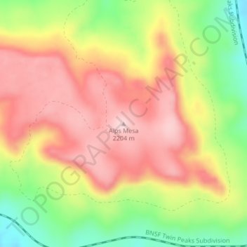
Name: Alps Mesa topographic map, elevation, terrain.
Location: Alps Mesa, Union County, New Mexico, United States (36.92553 -103.89113 36.92563 -103.89103)
Average elevation: 2,088 m
Minimum elevation: 1,942 m
Maximum elevation: 2,202 m
Make a donation
Other topographic maps
Click on a map to view its topography, its elevation and its terrain.
Clayton Lake State Park and Dinosaur Trackways
United States > New Mexico > Union County
Average elevation: 1,606 m
Clayton
United States > New Mexico > Union County
According to the United States Census Bureau, the town has a total area of 4.7 square miles (12 km2), all land. Clayton has an elevation of approximately 5,050 feet (1,540 m) above sea level. It is located about 130 miles (210 km) northwest of Amarillo, Texas. Clayton is considered to be in the Plains region…
Average elevation: 1,526 m