
Thank you for supporting this site ❤️
Make a donation
Make a donation
Wes topographic map
Click on the map to display elevation.
Thank you for supporting this site ❤️
Make a donation
Make a donation
About this map
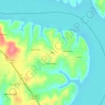
Name: Wes topographic map, elevation, terrain.
Location: Wes, Pawnee County, Oklahoma, United States (36.19202 -96.28918 36.23202 -96.24918)
Average elevation: 240 m
Minimum elevation: 218 m
Maximum elevation: 292 m
Thank you for supporting this site ❤️
Make a donation
Make a donation
Other topographic maps
Click on a map to view its topography, its elevation and its terrain.