
Thank you for supporting this site ❤️
Make a donation
Make a donation
Stasegem topographic map
Click on the map to display elevation.
Thank you for supporting this site ❤️
Make a donation
Make a donation
About this map
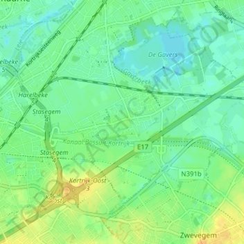
Name: Stasegem topographic map, elevation, terrain.
Location: Stasegem, Harelbeke, Kortrijk, Westflandern, 8530, Belgien (50.81134 3.29340 50.85134 3.33340)
Average elevation: 18 m
Minimum elevation: 7 m
Maximum elevation: 35 m
Thank you for supporting this site ❤️
Make a donation
Make a donation