
Thank you for supporting this site ❤️
Make a donation
Make a donation
Champ topographic map
Click on the map to display elevation.
Thank you for supporting this site ❤️
Make a donation
Make a donation
About this map
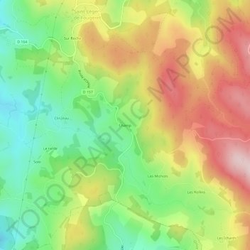
Name: Champ topographic map, elevation, terrain.
Average elevation: 482 m
Minimum elevation: 330 m
Maximum elevation: 661 m
Thank you for supporting this site ❤️
Make a donation
Make a donation
Other topographic maps
Click on a map to view its topography, its elevation and its terrain.
Les Ichards
France > Bourgogne-Franche-Comté > Nièvre > Saint-Léger-de-Fougeret > Les Ichards
Average elevation: 528 m