
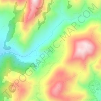
Komi topographic map
Interactive map
Click on the map to display elevation.
About this map
Name: Komi topographic map, elevation, terrain.
Average elevation: 842 m
Minimum elevation: 531 m
Maximum elevation: 1,217 m
Other topographic maps
Click on a map to view its topography, its elevation and its terrain.
Levidi
Greece > Peloponnese, Western Greece and the Ionian > Arcadia Regional Unit > Municipal Unit of Levidi
Levidi, Municipal Unit of Levidi, Municipality of Tripoli, Arcadia Regional Unit, Peloponnese Region, Peloponnese, Western Greece and the Ionian, 220 02, Greece
Average elevation: 935 m