
El Ayadi Barbes topographic map
Interactive map
Click on the map to display elevation.
About this map
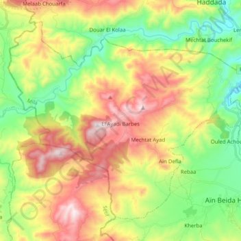
Name: El Ayadi Barbes topographic map, elevation, terrain.
Location: El Ayadi Barbes, Daïra Aïn Beida Harriche, Mila, Algérie (36.38597 5.74682 36.48890 5.90288)
Average elevation: 691 m
Minimum elevation: 361 m
Maximum elevation: 1,141 m
Other topographic maps
Click on a map to view its topography, its elevation and its terrain.
Mechtat Ghar Ezitoune
Algérie > Mila > Daïra Aïn Beida Harriche > El Ayadi Barbes
Average elevation: 671 m