
Wolpertshausen topographic map
Interactive map
Click on the map to display elevation.
About this map
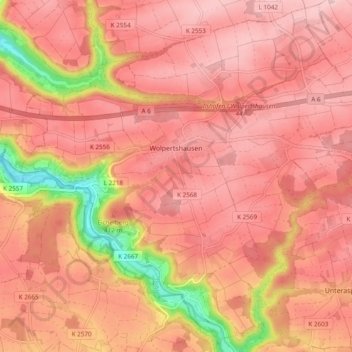
Name: Wolpertshausen topographic map, elevation, terrain.
Average elevation: 410 m
Minimum elevation: 255 m
Maximum elevation: 471 m
Other topographic maps
Click on a map to view its topography, its elevation and its terrain.
Cröffelbach
Duitsland > Baden-Württemberg > Landkreis Schwäbisch Hall > Wolpertshausen
Cröffelbach, Wolpertshausen, Verwaltungsverband Ilshofen-Vellberg, Landkreis Schwäbisch Hall, Baden-Württemberg, 74549, Duitsland
Average elevation: 394 m