Bhairav Takura topographic map
Interactive map
Click on the map to display elevation.
About this map
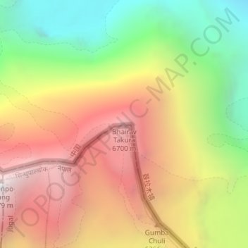
Name: Bhairav Takura topographic map, elevation, terrain.
Average elevation: 5,843 m
Minimum elevation: 4,678 m
Maximum elevation: 6,966 m

Click on the map to display elevation.
Name: Bhairav Takura topographic map, elevation, terrain.
Average elevation: 5,843 m
Minimum elevation: 4,678 m
Maximum elevation: 6,966 m