
Častá topographic map
Interactive map
Click on the map to display elevation.
About this map
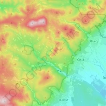
Name: Častá topographic map, elevation, terrain.
Location: Častá, okres Pezinok, Région de Bratislava, 900 89, Slovaquie (48.37219 17.25013 48.43823 17.38902)
Average elevation: 318 m
Minimum elevation: 174 m
Maximum elevation: 688 m
Other topographic maps
Click on a map to view its topography, its elevation and its terrain.
Pezinok
Slovaquie > Région de Bratislava > okres Pezinok
Pezinok, okres Pezinok, Région de Bratislava, Slovaquie
Average elevation: 300 m