
Thank you for supporting this site ❤️
Make a donation
Make a donation
Straume topographic map
Click on the map to display elevation.
Thank you for supporting this site ❤️
Make a donation
Make a donation
About this map
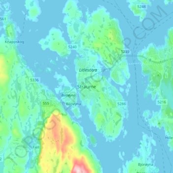
Name: Straume topographic map, elevation, terrain.
Location: Straume, Øygarden, Вестланн, 5353, Норвегия (60.31838 5.08351 60.39838 5.16351)
Average elevation: 35 m
Minimum elevation: -7 m
Maximum elevation: 326 m
Thank you for supporting this site ❤️
Make a donation
Make a donation
Other topographic maps
Click on a map to view its topography, its elevation and its terrain.