
坑口 Hang Hau topographic map
Interactive map
Click on the map to display elevation.
About this map
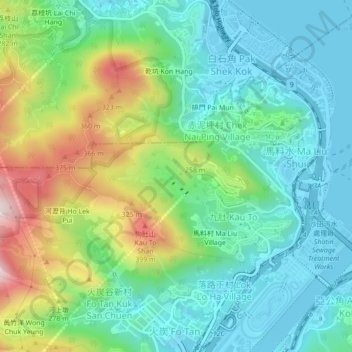
Name: 坑口 Hang Hau topographic map, elevation, terrain.
Location: 坑口 Hang Hau, 沙田區 Sha Tin District, Hong Kong, DD176 781, RPC (22.39469 114.17556 22.43469 114.21556)
Average elevation: 137 m
Minimum elevation: -4 m
Maximum elevation: 463 m