
Chandler topographic map
Interactive map
Click on the map to display elevation.
About this map
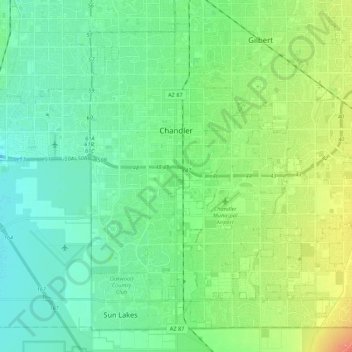
Name: Chandler topographic map, elevation, terrain.
Location: Chandler, Maricopa County, Arizona, États-Unis d'Amérique (33.20376 -111.97223 33.36134 -111.75533)
Average elevation: 372 m
Minimum elevation: 349 m
Maximum elevation: 438 m
Other topographic maps
Click on a map to view its topography, its elevation and its terrain.
Fountain Hills
États-Unis d'Amérique > Arizona > Maricopa County
Fountain Hills, Maricopa County, Arizona, 85268, États-Unis d'Amérique
Average elevation: 503 m
Chandler
États-Unis d'Amérique > Arizona > Maricopa County > Chandler
Chandler, Maricopa County, Arizona, 85225-7872, États-Unis d'Amérique
Average elevation: 386 m