
Tandil topographic map
Interactive map
Click on the map to display elevation.
About this map
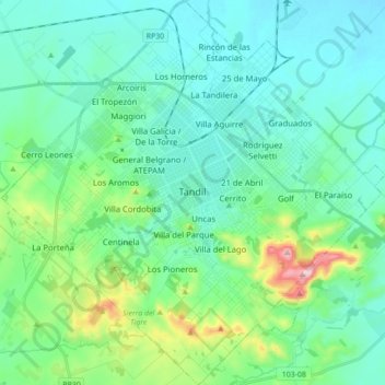
Name: Tandil topographic map, elevation, terrain.
Location: Tandil, Partido de Tandil, Buenos Aires, Argentina (-37.40508 -59.22751 -37.27342 -59.04152)
Average elevation: 227 m
Minimum elevation: 162 m
Maximum elevation: 499 m