
Gateshead topographic map
Interactive map
Click on the map to display elevation.
About this map
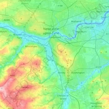
Name: Gateshead topographic map, elevation, terrain.
Location: Gateshead, Tyne and Wear, North East England, Engeland, VK (54.87776 -1.85272 54.98453 -1.51035)
Average elevation: 82 m
Minimum elevation: -3 m
Maximum elevation: 311 m