
Thank you for supporting this site ❤️
Make a donation
Make a donation
Bungalow topographic map
Click on the map to display elevation.
Thank you for supporting this site ❤️
Make a donation
Make a donation
Bungalow
The area is dominated by Snaefell Mountain with an elevation of 621m (2036 feet) above sea level and the nearby summits of Beinn-y-Phott (544m), Mullagh Ouyr (491m), Carraghan (500m), Clagh Ouyr (551m) and North Barrule (565m).
Thank you for supporting this site ❤️
Make a donation
Make a donation
About this map
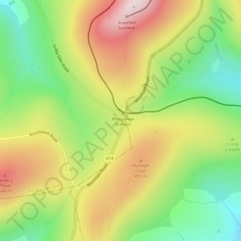
Name: Bungalow topographic map, elevation, terrain.
Location: Bungalow, Lezayre, Ayre, Isle of Man (54.24047 -4.47417 54.26047 -4.45417)
Average elevation: 388 m
Minimum elevation: 188 m
Maximum elevation: 619 m
Thank you for supporting this site ❤️
Make a donation
Make a donation