
Thank you for supporting this site ❤️
Make a donation
Make a donation
Belitung Timur topographic map
Click on the map to display elevation.
Thank you for supporting this site ❤️
Make a donation
Make a donation
About this map
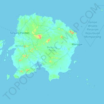
Name: Belitung Timur topographic map, elevation, terrain.
Location: Belitung Timur, Bangka-Belitung Islands, Sumatra, Indonesia (-3.41505 107.75055 -2.49188 108.87049)
Average elevation: 7 m
Minimum elevation: -2 m
Maximum elevation: 424 m
Thank you for supporting this site ❤️
Make a donation
Make a donation
Other topographic maps
Click on a map to view its topography, its elevation and its terrain.