
Muanda topographic map
Interactive map
Click on the map to display elevation.
About this map
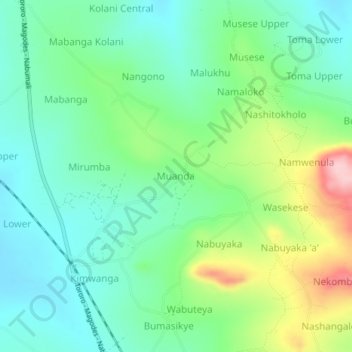
Name: Muanda topographic map, elevation, terrain.
Location: Muanda, Bugisa sub-region, Mbale, Eastern Region, Ouganda (0.87704 34.15831 0.91704 34.19831)
Average elevation: 1,200 m
Minimum elevation: 1,142 m
Maximum elevation: 1,333 m
Other topographic maps
Click on a map to view its topography, its elevation and its terrain.
Kibembe
Ouganda > Mbale > Bugisa sub-region
Kibembe, Bugisa sub-region, Mbale, Eastern Region, Ouganda
Average elevation: 1,409 m