
Thank you for supporting this site ❤️
Make a donation
Make a donation
Rheinfelden topographic map
Click on the map to display elevation.
Thank you for supporting this site ❤️
Make a donation
Make a donation
About this map
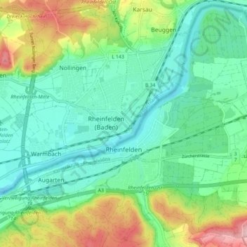
Name: Rheinfelden topographic map, elevation, terrain.
Location: Rheinfelden, Bezirk Rheinfelden, Argovie, 4310, Suisse (47.53272 7.75529 47.58800 7.83852)
Average elevation: 318 m
Minimum elevation: 259 m
Maximum elevation: 455 m
Thank you for supporting this site ❤️
Make a donation
Make a donation