
Oldendorf topographic map
Interactive map
Click on the map to display elevation.
About this map
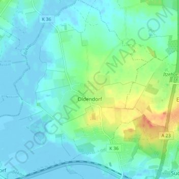
Name: Oldendorf topographic map, elevation, terrain.
Average elevation: 10 m
Minimum elevation: -4 m
Maximum elevation: 42 m
Other topographic maps
Click on a map to view its topography, its elevation and its terrain.
Horst
Duitsland > Sleeswijk-Holstein > Kreis Steinburg
Horst, Horst-Herzhorn, Kreis Steinburg, Sleeswijk-Holstein, 25358, Duitsland
Average elevation: 5 m