
金水镇 topographic map
Interactive map
Click on the map to display elevation.
About this map
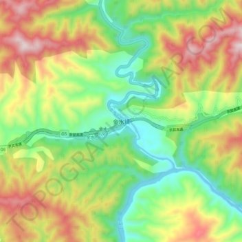
Name: 金水镇 topographic map, elevation, terrain.
Location: 金水镇, 洋县, 汉中市, 陕西省, 中国 (33.23999 107.80672 33.31999 107.88672)
Average elevation: 739 m
Minimum elevation: 414 m
Maximum elevation: 1,194 m
Other topographic maps
Click on a map to view its topography, its elevation and its terrain.