
Western Downs Regional topographic map
Interactive map
Click on the map to display elevation.
About this map
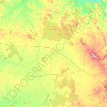
Name: Western Downs Regional topographic map, elevation, terrain.
Location: Western Downs Regional, Queensland, Australia (-28.01458 149.09727 -25.59892 151.67450)
Average elevation: 338 m
Minimum elevation: 105 m
Maximum elevation: 1,091 m
Other topographic maps
Click on a map to view its topography, its elevation and its terrain.
Toowoomba
The city occupies the edge of the range and the low ridges behind it. Two valleys run north from the southern boundary, each arising from springs either side of Middle Ridge near Spring Street at an altitude of around 680 m. These waterways, East Creek and West Creek, flow together just north of the CBD to…
Average elevation: 458 m