
Frederiksberg Kommune topographic map
Interactive map
Click on the map to display elevation.
About this map
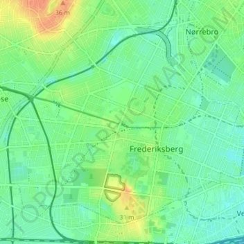
Name: Frederiksberg Kommune topographic map, elevation, terrain.
Location: Frederiksberg Kommune, Hauptstadtregion, Dänemark (55.66650 12.49132 55.69768 12.55734)
Average elevation: 15 m
Minimum elevation: 2 m
Maximum elevation: 39 m
Other topographic maps
Click on a map to view its topography, its elevation and its terrain.