
Thank you for supporting this site ❤️
Make a donation
Make a donation
Isongo topographic map
Click on the map to display elevation.
Thank you for supporting this site ❤️
Make a donation
Make a donation
About this map
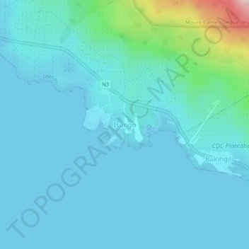
Name: Isongo topographic map, elevation, terrain.
Location: Isongo, Idenau, Fako, Southwest, Cameroon (4.05059 8.99879 4.09059 9.03879)
Average elevation: 31 m
Minimum elevation: -2 m
Maximum elevation: 259 m
Thank you for supporting this site ❤️
Make a donation
Make a donation
Other topographic maps
Click on a map to view its topography, its elevation and its terrain.