
Thank you for supporting this site ❤️
Make a donation
Make a donation
Masca topographic map
Click on the map to display elevation.
Thank you for supporting this site ❤️
Make a donation
Make a donation
About this map
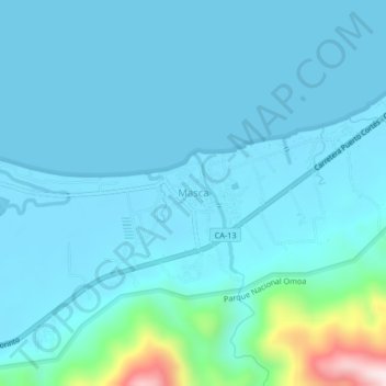
Name: Masca topographic map, elevation, terrain.
Location: Masca, Omoa, Cortés, Honduras (15.65963 -88.15705 15.69963 -88.11705)
Average elevation: 54 m
Minimum elevation: -1 m
Maximum elevation: 511 m
Thank you for supporting this site ❤️
Make a donation
Make a donation
Other topographic maps
Click on a map to view its topography, its elevation and its terrain.