
Thank you for supporting this site ❤️
Make a donation
Make a donation
Dukupuntang topographic map
Click on the map to display elevation.
Thank you for supporting this site ❤️
Make a donation
Make a donation
About this map
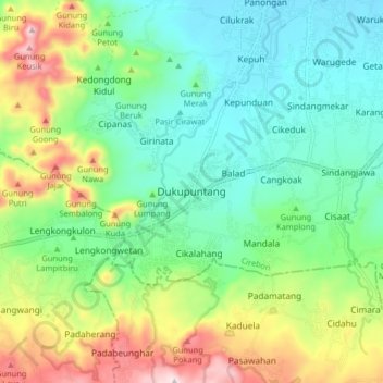
Name: Dukupuntang topographic map, elevation, terrain.
Location: Dukupuntang, Cirebon, West Java, Java, 45652, Indonesia (-6.80873 108.37496 -6.72873 108.45496)
Average elevation: 194 m
Minimum elevation: 29 m
Maximum elevation: 546 m
Thank you for supporting this site ❤️
Make a donation
Make a donation