
Mischendorf topographic map
Interactive map
Click on the map to display elevation.
About this map
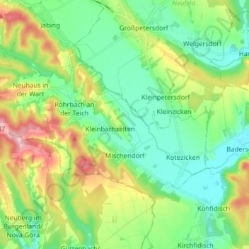
Name: Mischendorf topographic map, elevation, terrain.
Location: Mischendorf, Bezirk Oberwart, Burgenland, 7511, Österreich (47.17853 16.22746 47.23041 16.35586)
Average elevation: 295 m
Minimum elevation: 247 m
Maximum elevation: 396 m