
Thank you for supporting this site ❤️
Make a donation
Make a donation
Putla topographic map
Click on the map to display elevation.
Thank you for supporting this site ❤️
Make a donation
Make a donation
About this map
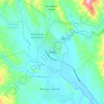
Name: Putla topographic map, elevation, terrain.
Location: Putla, Putla Villa de Guerrero, Oaxaca, México (16.98640 -97.96823 17.06640 -97.88823)
Average elevation: 802 m
Minimum elevation: 707 m
Maximum elevation: 1,252 m
Thank you for supporting this site ❤️
Make a donation
Make a donation