
Thank you for supporting this site ❤️
Make a donation
Make a donation
Tapango topographic map
Click on the map to display elevation.
Thank you for supporting this site ❤️
Make a donation
Make a donation
About this map
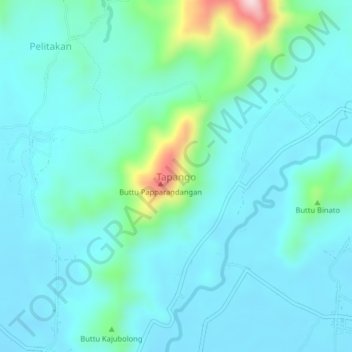
Name: Tapango topographic map, elevation, terrain.
Location: Tapango, Polewali Mandar, West Sulawesi, Sulawesi, Indonesia (-3.35310 119.19709 -3.31310 119.23709)
Average elevation: 69 m
Minimum elevation: 12 m
Maximum elevation: 375 m
Thank you for supporting this site ❤️
Make a donation
Make a donation
Other topographic maps
Click on a map to view its topography, its elevation and its terrain.