
Thank you for supporting this site ❤️
Make a donation
Make a donation
Aweida topographic map
Click on the map to display elevation.
Thank you for supporting this site ❤️
Make a donation
Make a donation
About this map
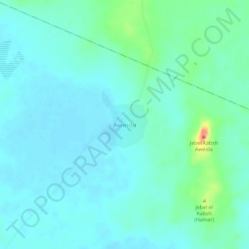
Name: Aweida topographic map, elevation, terrain.
Location: Aweida, Ghubaysh, West Kurdufan State, Sudan (13.08633 27.47291 13.12633 27.51291)
Average elevation: 542 m
Minimum elevation: 530 m
Maximum elevation: 594 m
Thank you for supporting this site ❤️
Make a donation
Make a donation