
San José del Valle topographic map
Interactive map
Click on the map to display elevation.
About this map
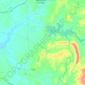
Name: San José del Valle topographic map, elevation, terrain.
Average elevation: 149 m
Minimum elevation: 13 m
Maximum elevation: 846 m
Other topographic maps
Click on a map to view its topography, its elevation and its terrain.
Xérès
Espagne > Andalousie > Campiña de Jerez
Xérès, Campiña de Jerez, Cadix, Andalousie, Espagne
Average elevation: 44 m