Ahlen topographic map
Interactive map
Click on the map to display elevation.
About this map
![Ahlen topographic map, elevation, terrain](/pub/maps/relation/8c14/5jx5k/thumbnail.jpg)
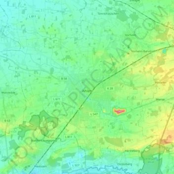
Name: Ahlen topographic map, elevation, terrain.
Location: Ahlen, Kreis Warendorf, North Rhine-Westphalia, Germany (51.70014 7.78820 51.83131 7.99161)
Average elevation: 81 m
Minimum elevation: 57 m
Maximum elevation: 157 m
Other topographic maps
Click on a map to view its topography, its elevation and its terrain.
![Drensteinfurt topographic map, elevation, terrain](/pub/maps/relation/mz1h/b5957/icon.jpg)
Drensteinfurt
Germany > North Rhine-Westphalia > Kreis Warendorf
Drensteinfurt, Kreis Warendorf, North Rhine-Westphalia, 48317, Germany
Average elevation: 69 m
![Vellern topographic map, elevation, terrain](/pub/maps/node/fqgt/tqmkw57/icon.jpg)
Vellern
Germany > North Rhine-Westphalia > Kreis Warendorf > Beckum
Vellern, Beckum, Kreis Warendorf, North Rhine-Westphalia, 59269, Germany
Average elevation: 129 m
![Oelde topographic map, elevation, terrain](/pub/maps/relation/hgtp/8m1dn/icon.jpg)
Oelde
Germany > North Rhine-Westphalia > Kreis Warendorf
Oelde, Kreis Warendorf, North Rhine-Westphalia, 59302, Germany
Average elevation: 100 m
![Wadersloh topographic map, elevation, terrain](/pub/maps/relation/vk51/9k3kl/icon.jpg)
Wadersloh
Germany > North Rhine-Westphalia > Kreis Warendorf
Wadersloh, Kreis Warendorf, North Rhine-Westphalia, Germany
Average elevation: 87 m
![Sassenberg topographic map, elevation, terrain](/pub/maps/relation/ng51/9xdkl/icon.jpg)
Sassenberg
Germany > North Rhine-Westphalia > Kreis Warendorf
Sassenberg, Kreis Warendorf, North Rhine-Westphalia, 48336, Germany
Average elevation: 62 m