
San Agustin topographic map
Interactive map
Click on the map to display elevation.
About this map
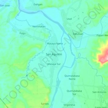
Name: San Agustin topographic map, elevation, terrain.
Location: San Agustin, Isabela, Valle del Cagayán, Filipinas (16.46670 121.70741 16.54670 121.78741)
Average elevation: 122 m
Minimum elevation: 85 m
Maximum elevation: 297 m
Other topographic maps
Click on a map to view its topography, its elevation and its terrain.
San Guillermo
Filipinas > Isabela > San Guillermo
San Guillermo, Isabela, Valle del Cagayán, 3308, Filipinas
Average elevation: 149 m