
Surhuisterveen topographic map
Interactive map
Click on the map to display elevation.
About this map
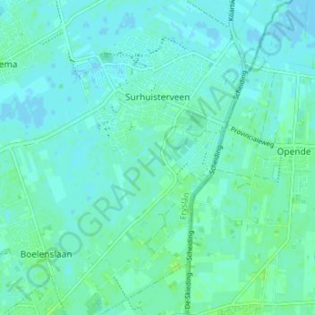
Name: Surhuisterveen topographic map, elevation, terrain.
Location: Surhuisterveen, Achtkarspelen, Friesland, Niederlande (53.15603 6.12251 53.18935 6.18813)
Average elevation: 3 m
Minimum elevation: -1 m
Maximum elevation: 9 m
Other topographic maps
Click on a map to view its topography, its elevation and its terrain.
Drogeham
Niederlande > Friesland > Achtkarspelen
Drogeham, Achtkarspelen, Friesland, Niederlande
Average elevation: 2 m
Augustinusga
Niederlande > Friesland > Achtkarspelen
Augustinusga, Achtkarspelen, Friesland, Niederlande
Average elevation: 1 m
Surhuizum
Niederlande > Friesland > Achtkarspelen
Surhuizum, Achtkarspelen, Friesland, Niederlande
Average elevation: 1 m
Boelenslaan
Niederlande > Friesland > Achtkarspelen
Boelenslaan, Achtkarspelen, Friesland, Niederlande
Average elevation: 3 m