
Thank you for supporting this site ❤️
Make a donation
Make a donation
Phu Ruea topographic map
Click on the map to display elevation.
Thank you for supporting this site ❤️
Make a donation
Make a donation
Phu Ruea
The Phu Ruea High Altitude Agricultural Research Station is on the mountain and Phu Ruea National Park encompasses the peak. The park borders Sainyabuli province in Laos at its northern end. Most of the mountain is covered in mixed evergreen forest. The area around the mountain is part of the Luang Prabang montane rain forests ecoregion.
Thank you for supporting this site ❤️
Make a donation
Make a donation
About this map
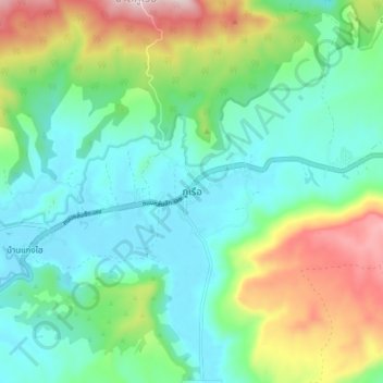
Name: Phu Ruea topographic map, elevation, terrain.
Location: Phu Ruea, Loei Province, 42160, Thailand (17.41170 101.32196 17.49170 101.40196)
Average elevation: 752 m
Minimum elevation: 600 m
Maximum elevation: 1,130 m
Thank you for supporting this site ❤️
Make a donation
Make a donation